Brief by Central Staff
Geography – August 2003 – Colorado Central Magazine
Several wildfires were burning as we went to press, including one near a rather obscure spot named “Dotsero.” That’s also the name of a jazz band which usually plays in Salida every fall, but there’s more to Dotsero’s lore.
The settlement (it’s not incorporated and it doesn’t have a post office) is in Eagle County near the junction of the Eagle River with the Colorado River.
On that account, you could call it the town that put Salida out of business — the railroad business, anyway. Go back 75 years, and you had the Denver & Salt Lake Railway extending from Denver west through the Moffat Tunnel, down the Colorado River for a few dozen miles, then climbing up Rock Creek to head northwest for Steamboat Springs and Craig, where it dead-ended.
The line that connected to the West Coast was the Denver & Rio Grande Western’s route: south from Denver to Pueblo, west to Salida, north past Leadville to cross Tennessee Pass, then down the Eagle River to the Colorado River (Dotsero), and on west to Grand Junction, Salt Lake City, and eventually the Pacific Ocean.
These two routes came within 40 miles of each other — and water-level miles along the Colorado River at that — and so it was almost inevitable that they would be connected.
[InContentAdTwo]
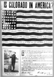
That connection was the “Dotsero Cut-off” in 1937, and a few years later, the D&SL was merged into the D&RGW. The result was that more traffic was shifted to the more direct route west from Denver (the Moffat Tunnel Route) and less followed the indirect course (the Royal Gorge Route). Thanks to the Dotsero Cut-off, Salida lost its role as a railroad center.
As for how Dotsero got its name, there are several theories. Dale Sanderson of Denver (one of the name-givers of Headwaters Hill) delights in collecting Colorado lore, and he goes with a railroad name — it’s where the survey started for the new connecting line in the 1930s, and it was marked on the maps as .0 (“dot zero”)
Some sources say the town’s pronunciation reflects that, as in “dot-SEER-oh,” but the jazz band pronounces it “dot-SEHR-oh.”
On the east end of the Dotsero Cut-off is the railroad junction named Orestod — Dotsero spelled backward. If you’re trying to find it on a map, it’s close to the town of Bond in Eagle County.
In Colorado geology, Dotsero is famous as the site of the state’s most recent volcanic eruption. While most lava flows in Colorado date back millions of years, the Dotsero volcano erupted only 4,140 years ago. It left a crater about half a mile across and 1,300 feet deep, along with nearly two miles of lava flow.
Was it as much a spectacle as a forest fire? Probably not. Allen Best, a frequent contributor to these pages, once researched the Dotsero Volcano for a story in an Eagle County paper. He called it “the Barry Manilow of volcanoes.”