The Pipeline of Dreams

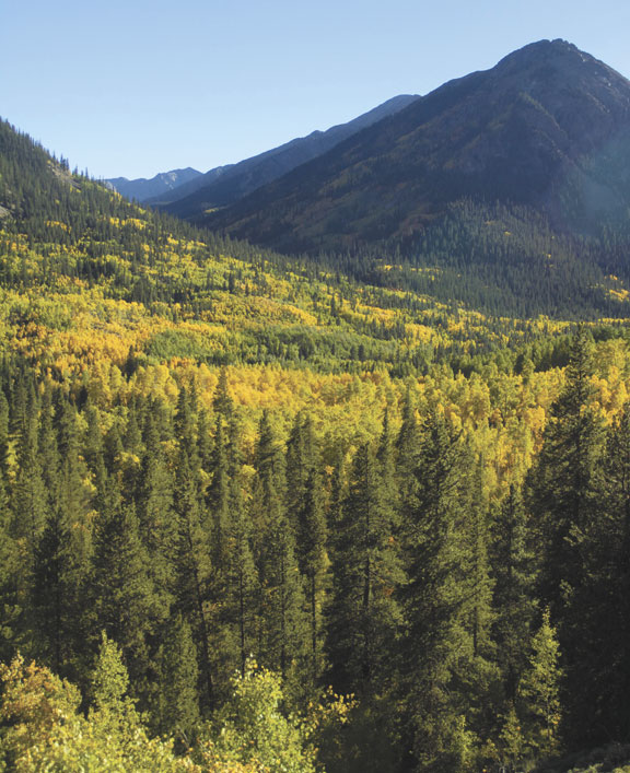
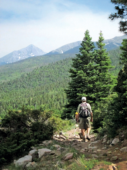
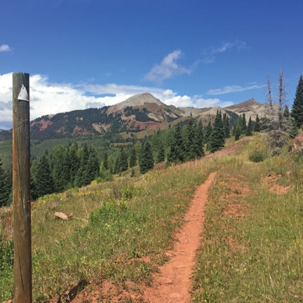
By Brad Klafehn There’s a pipeline which runs through Central Colorado. Known best to its owners and maintainers, it unobtrusively carries an invisible commodity north and south. Not oil, natural gas, or carbon dioxide, it carries the hopes and aspirations of a class of active dreamers who take to foot and wheel on long-distance journeys …

Read more

The Rusty Lung: Salida’s Newest Trail

By Mike Rosso

Since 2006, a group of volunteers named Salida Mountain Trails (SMT) have been steadily increasing the number and quality of non-motorized, multi-use trails in the Salida vicinity.

Margaret Knight on the new Rusty Lung Trail near Salida. Photo by Ben Knight, feltsoulmedia.com

The latest addition to the extensive trail system harkens back to the early days of mountain biking in the area. Back in the 1980s, mountain biking was beginning to be taken up by more and more riders. It offered an off-road, nature-based experience. Two early Salida pioneers of the sport, Don McClung and the late Mike Rust, developed a loop trail on the backside of Tenderfoot Mountain on Bureau of Land Management property. It was steep, rocky and challenging, especially in the pre-suspension days of the ‘80s, and named The Sunset Trail by another early Salida mountain biker, Jack Chivvis.

McClung, a bike designer and builder, began riding what he called “a faint animal game trail,” in a 1988 Mountain Mail story about the mountain biking opportunities which were opening up back then. Unfortunately, the original trail disappeared in private property and was eventually abandoned as new, legal trails began popping up.

Read more

Sheep’s Gulch Trail

by Ericka Kastner

Some might call it “the trail that gets forgotten.” Most wilderness lovers traveling down County Road 390 near Granite are likely headed towards one of the many 14,000-foot peaks in the area. They’ve possibly never heard of Sheep’s Gulch Trail.

At least I hadn’t until yesterday, literally. A friend and I were on a quest for a gorgeous fall hike that would be rich with color and take us above tree line. He suggested Sheep’s Gulch and I was immediately intrigued, as I love discovering new trails.

Sheep’s Gulch trailhead is on the north side of CR 390, about 8.9 miles from its intersection with U.S. Highway 24. Even the two-wheel-drive accessible route to the trailhead is spectacular, and worth the drive alone, as it includes stunning views of Clear Creek Reservoir, historic cabin sightings along the way (check out Dawson Cabin about 5.8 miles along the road or the Vicksburg Museum at mile 7.2) and glorious valley vistas in the distance.

Read more

Happy Trails: The New Colorado Trail Basecamp

By Tyler Grimes

Mile for mile the beautiful trail in America,” boasts the Colorado Trail Foundation (CTF) of the 468-mile trail between Waterton Canyon southwest of Denver to Durango. Thousands hike the free-to-the-public trail, some day users, others straight through. “In 2015, there were 230 known CT completers, a hodgepodge of multi-year section doers and thru-travelers: hike, bike and horse,” said Bill Manning, CTF Executive Director. The CT spans five national forests through 11 ranger districts and six wilderness areas, climbing from a mile high to over 13,000 feet. “Trips range from less than an hour to more than a month,” said Manning. “Possibly the most engaged users are the thru-hikers striving to see all 486 miles in a single trip.”

Read more

Update: Vision of a Salida-to-Leadville Trail Along the Old Stage Road and Midland Railroad

By Alan Robinson

Readers of this magazine may recall the September 2008 article on “The Stage Road from Canon City to Leadville.” There I summarized the history of that 1870s passenger, mail and freight route, and 1880 construction of the long-abandoned Colorado Midland Railroad (CMRR) through Chaffee and Lake Counties. I also asked rhetorically if in today’s environment, where preservation of our area’s cultural heritage is increasingly recognized as important for both social and economic reasons, there might be an opportunity to develop a long-distance public heritage trail along those routes. The initial vision was to connect Buena Vista and southern Lake County with a slow-speed pathway of about 30 miles – some sections for vehicle travel, some for hikers, cyclists and horseback riders – which would celebrate the stories of those two routes, stimulate preservation of their deteriorating physical features, interpret their history to strengthen the public’s appreciation of their value, and in some cases, make sections now inaccessible open to public use.

Read more

The Rainbow Trail

By Mike Rosso

The Rainbow Trail, which celebrates its 101st birthday this year, could well be seen as an allegory for the various uses and controversies surrounding Colorado forest lands over the past century.

At just over 101 miles long, it spans four counties – Saguache, Chaffee, Fremont and Custer – and ends at the Huerfano County border.

Along its length, outdoor enthusiasts can access numerous 14,000 foot peaks, including Kit Carson (14,165’) and Crestone Peak (14,294’), and over a dozen alpine lakes. The Trail has an average elevation of 9,000 feet and winds in and out of thick spruce forests and aspen groves, as well as high mountain meadows. What initially began as a foot and horseback trail is now accessible to mountain bikes, motorcycles and, for the entire stretch in Custer County, all-terrain vehicles.

Read more

Colorado Rail Facts – May 2009

The Sargents Water Tank still stands in the village of Sargents (originally known as Marshalltown) on the east side of Monarch Pass.

Built in 1937 to replace a smaller tank, the tank served the D&RGRR narrow-gauge line running up Marshall Pass. Originally there were tanks located every few miles along the tracks but the Sargents tank is one of the few remaining.

Read more