Story and photos by Ericka Kastner
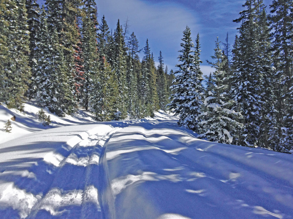
As I write this, a full moon is rising and will shine overhead this evening. There’s no place I’d rather witness this orb of night than at the top of the Continental Divide. Subsequently, I’ve spent countless full moons skiing on Old Monarch Pass, a mere thirty-minute drive from my downtown Salida loft.
The route is a favorite in my heart for numerous reasons. It is on this historic pass that I once gathered with a dozen or so women to snowshoe, sip hot toddies from a thermos and marvel at the night. Here, too, I’ve celebrated an anniversary with my love, as we skied over the pass and onto the other side under the moon’s glow, enjoying one another’s company and trying to name the countless peaks to the west. And it was on Old Monarch that I first shared the wonder of a snowy night lit by a full moon on a snowshoe with my youngest son one New Year’s Eve and first Nordic skied with my daughter on a clear Colorado day.
The relatively short route to the Divide is ideal for a novice Nordic tour or snowshoe, yet offers an option to go further over the pass towards Sargents, challenging more advanced skinny skiers in both distance and uphill climb on the return. Backcountry skiers and snowboarders will also find gentle terrain for making turns on nearby northeast facing slopes upon reaching the summit of the old pass.
[InContentAdTwo]
In the spring and summer, after snowmelt, the wildflower-laden forest and tundra of the Old Monarch double-track can be enjoyed as a hike, on mountain bikes or via car, and camping spots may be easily scouted along the road as well. When it’s not snowy, it’s also easier to see the Continental Divide Trail crossing the road about a mile in.
An 1880 “Old Old” Monarch Pass parallels the road a bit higher along the ridge to the northeast where nearby Monarch Mountain ski area now tops out. The original pass can still be seen on some topographic maps today, but is passable only on foot. In 1919, the FSR 237 route, or Old Monarch Pass, was created to make a shorter path to Gunnison. The 22-mile road cost about $10,000 per mile according to Alvin Edlund, Jr. (Colorado Central Magazine, Jan. 1999.)
The well-marked trailhead is easily accessed high atop the present-day Monarch Pass along U.S. Hwy. 50 between Poncha Springs and Gunnison. Travel west about 18.5 miles from the intersection of Hwy. 50 and U.S. Hwy. 285 in Poncha, and look for a parking area on the west side of the road. From Gunnison and the intersection of Hwy. 50 and C.R. 135, travel east 44.2 miles up and over Monarch Pass, looking for that same parking area on the west side of the road about 2.3 miles from the top of the pass. In winter, park your car and begin your tour here.
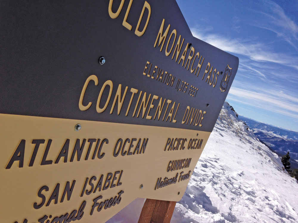
You’ll climb about 350 feet in elevation and reach the Continental Divide (11,375 feet) and the pass at a saddle about 1.3 miles from your car. I recommend continuing past the Divide onto the other side of the pass, at least a bit, so you can fully take in the spectacular views to the east and west.
Logophile and Places columnist Ericka Kastner thinks there’s nothing better than the kick and glide of skinny skis on a snowy Colorado bluebird day. View her work online at erickakastner.com.