In the northern San Luis Valley, County Road AA – known sometimes as Alanon Afterway – intersects Colorado Highway 17 about five miles south of the intersection of Highway 17 and U.S. 285. Highway 17 at Road AA is the corner of four surveying quadrangles, the northeastern of which is the Mirage Quad. Looking to the south from that point, you often see mirages rising off the flat floor of the Valley. To the west on Road AA is one access to the Saguache County Landfill, which explains why that stretch of Road AA is frequently littered with trash, blown out of untarped trucks on their way to the landfill.
Old timers and longtime locals identify Road AA as “Meer-age Lane.” The Valley is known for quirky pronunciations. Hooper, for example, is “Hupper.” And Alamosa is “Ala-moose-a.” Salida is “Slide-ah.” Pueblo is “Pee-ebb-low.” Buena Vista is “Bee-you-knee.” This may be a way for Valley gentry to distinguish those who know where they are from those who are just passing through.
If you park on the east side of Highway 17 at Meer-age Lane and look straight east in mid October, you will see a shape in the Sangres that resembles a cherry. As the aspen and alder of Wild Cherry Creek Canyon turn red in the fall, the tail of the Canyon resembles a long stem in certain light.
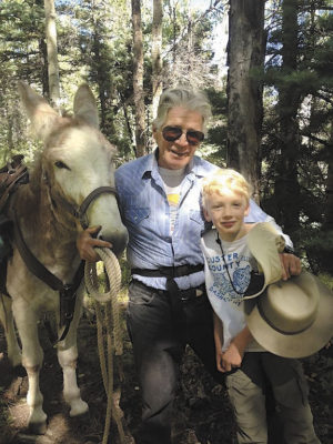
The trailhead for Wild Cherry is at the eastern dead end of Meer-age Lane. The road is good most of the way: gravel, then sand, and finally rock of the alluvial plain, often washed out for the final mile. While a high clearance vehicle with decent tires is a good idea, I have seen too many Crown Victorias and Buicks come down that road to discourage anyone from driving to the trailhead in whatever vehicle you have.
The trailhead billboard says it is four miles to Wild Cherry Lake. Someone correctly placed a zero after the four to more fairly represent the distance. Considering switchbacks and variation in terrain, it’s more like five miles, and as one gets older, it feels like eight miles, and sometimes like forty.
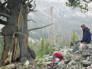
With all the usual cautions well known to hikers, this is one of the truly wonderful trails in the state. The creek cascades down in a loosely conducted medley of towering aspen mixed with evergreens (bristlecone pines near the top), huge rocks, berry patches and remnants of old debris-flows. Occasionally there are fragments of the Rockies from 165 million years ago that rose up about 12,000 feet from the Valley floor. The old rocks are usually purplish conglomerates fondly known as pudding stones.
There are bears in the berries sometimes, but for the most part they are not aggressive. One time I came around a bend in the trail and faced a black bear sitting on its bum in a raspberry patch, pinching off berries with the delicacy of an aristocrat eating caviar, one at a time. The bear scampered up the canyon wall and then stood, leaning thoughtfully against a protruding rock, with an expression that politely suggested I not pick any berries on my way home.
In late summer the undergrowth can be so thick as to cloud the trail and it isn’t uncommon for a fallen tree to block the path. About four miles up you come to a clearing where the creek literally comes out of the ground. The lake was formed by a massive rock and mud slide that dammed the canyon at a narrow point, and the water wended its way through a rock channel to emerge in this clearing. From the clearing, you continue up the trail that is cut into the rockslide, to reach the Wild Cherry Lake.
The lake has some old outlet works either from mining or early agriculture in the Valley, but the yield from Wild Cherry canyon is typically not enough to make it a reliable irrigation source. The creek flows in fits and starts, from a maximum of about ten cubic feet per second to two cubic feet per second by late summer – not enough to finish a crop that could be started with spring runoff.
[InContentAdTwo] There is an alternate way to the lake that is shorter, but more challenging – the Spring Creek approach. Few people know about this. To take this approach, you go up to the Cotton Creek trailhead (three miles north of Meer-age Lane off Road 65) and then head south on an old mining road to the first small canyon with a trickle of water, Spring Creek. The trail is not well maintained and a machete and compass are recommended. Ascending Spring Creek, you will pass two northern forks. After the second north-leading fork there is a rough hunters’ hut with pole hangers for game. Parenthetically, if you take either of these northern forks, you will ascend and then drop down into Cotton Creek. It can be difficult to get across Cotton Creek from this stretch because the terrain is deeply littered with fallen trees and dense brush.
To take the Spring Creek short cut to Cherry Lake, you need to go pass the second fork about half a mile through dense treefall beyond the hunters’ hut, and then head uphill at a gradual gradient in a south-easterly direction until you reach the crest and can look down on the clearing where the Creek comes out of the ground, and the Lake beyond it to the east. This is a spectacular approach to Wild Cherry Lake, but also the one that you should let someone know you are taking before you go.
Thunderstorms can hit, everything from a little turtle-turner to a fast-moving goose-drowner to a full-blown frog-strangler. It is common in the Valley in the summer for the days that start cloudless and calm to be the ones that bring the most violent storms. Humans, particularly in the highly recreated West, seek contact with wild spaces. It is probably the same desire that led Homo sapiens out of Africa some 200,000 years ago. We will always wonder: what is around the next bend, how many ways can a person get from here to there, and what can be seen from the top of the next ridge …
John Mattingly cultivates prose, among other things, and was most recently seen near Poncha Springs.