
Brief by Central Staff
Geography – March 2002 – Colorado Central Magazine
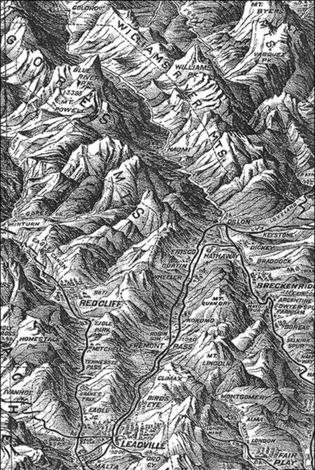
Curious about the Colorado of 1894? Then the U.S. Geological Survey has just republished a map that should answer a few questions.
The map, originally developed by the Caxton Co. and published by James McConnell School Supplies of Denver, had languished in the archives of the Library of Congress for years before it was discovered last summer by Peggy Ellis, who was on vacation in Washington, D.C., from her regular work at the U.S. Geological Survey in Lakewood.

It was in six pieces, but thanks to her work, she knew where to turn — to Kirk Volkel, a cartographer at the U.S.G.S., who spent about a week digitally stitching the pieces together.
“The map is amazingly accurate for the time period,” he observed, and it has some places that haven’t appeared on maps for years, like Kokomo, now buried under Climax tailings, and Montgomery, now under a reservoir.
The U.S.G.S. sells the 53″x42″ map for $12, and you should also be able to get one from a local map dealer. Indeed, when we checked on that with Dick Scar at the Trailhead in Buena Vista, he said he planned to add some to his next order, and so he should have some in stock now.