
Article by Dave McCullough
Photos by Roy Joseph and Scott McCullough
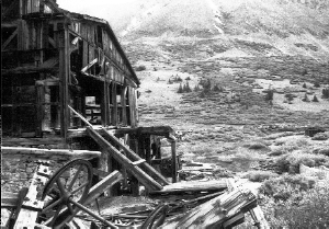
Back roads – July 2000 – Colorado Central Magazine
A ROAD IS AN OPEN ROUTE or public way for the passage of vehicles, persons, and animals. To separate the many roads or two-tracks in the Central Colorado mountains into the worst category requires some clarification of “worst road.” In general, the worst roads are still capable of transporting people in a vehicle along a public way.
But there are rights-of-way originally developed for access to logging, mining, and/or grazing areas that have been all but obliterated by thunderstorms, spring runoffs, and avalanches — and the very worst routes have eroded well beyond the definition of open way for the general public.
The few who challenge those tracks often tolerate scratched paint, sheet metal damage, rollovers, broken U-joints, snapped axle shafts, and some serious shop time. Such routes are not considered usable by the general public, but a distinct group of two-tracks remains open to willing and courageous adventurers. And the lure of a fishing hole, ghost town, relict mine, and spectacular scenery waits at the end of a bumpy ride.

At the end of the Wheeler Lake Road.
Since the end of World War II, many people have hunted, fished, and explored the wilds. As wheeled toys grew in ability, so did the ambitions of the owners. Vehicles capable of conveying passengers along the worst roads have often been somewhat modified to traverse washouts, ruts, boulders, ledges, steep sections, and deep streams.
Four-wheel drive vehicles come to mind, especially Jeeps, old Broncos, and Toyota Land Cruisers. In many cases, the owner/operators of these rigs have upgraded their vehicles for the purpose of traversing into the desolate regions of the mountains and deserts within the Forest Service and BLM domain — by making some improvements in lifted suspensions, larger tires, and modified differentials.
A few ratings systems are used to measure a road’s usability. The Red Rock 4-Wheelers host the annual Easter Jeep Safari — so numerous safarians putter on four-wheel drive trails around Moab, Utah. The Moab club uses an old system to rate trails: 2 is the lowest rating, and is applied to unimproved or rarely graded roads. 4½ is the most extreme. A trail that is rated 4½ requires low gears, tall tires, limber suspension, and limited-slip or locked differentials. According to Red Rocks Four-Wheelers, “It is common to have as many as 10% of the vehicles experience major mechanical failures (gears, axles, drive shafts) on these trails.”

On the road to Wheeler Lake
GUIDE BOOKS use different rating systems. 4WD Adventures Colorado by Peter Massey and Jeanne Wilson uses a scale of 1 to 10. “One is passable for a normal passenger vehicle in good condition. Ten requires a heavily modified vehicle and an experienced driver who is willing to expect vehicle damage.”
Massey and Wilson do not list trails with difficulty ratings above 7 because “stock vehicles are likely to be damaged and may find the trail impassable.” These trails are well beyond the scope of their book. Their guide targets most Spewt owners.
Charles Wells, Colorado Springs author, uses a simple system in his Colorado Backroads & 4-Wheel Drive Trails books: easy, moderate, and difficult. Easy routes can be traversed by two-wheel drives during dry periods. Moderate roads are accessible for most Spewts.
[InContentAdTwo]
Wells describes difficult: “Generally suitable for more aggressive stock vehicles or modified vehicles. Lifts, differential lockers, aggressive articulation, and/or winches recommended on some trails. Skid plates and tow hooks required. Body damage possible on some obstacles. Grades can be steep with severe ground undulations. Off-camber areas can be extreme. Water depths extremely deep. Shelf roads extremely narrow; full-size vehicles use caution and read trail descriptions carefully. Passing may be difficult with backing required for long distances. Brush may scrape sides of vehicle. Deep mud bogs possible.”
THE SIMPLEST WAY to list the ten worst roads in Central Colorado (with an expansive view that includes the San Juans) is to use Charles Wells’s system. He is quick to admit that many routes are best left out of his books — because the lure would result in people attempting such extreme passages with resulting vehicle damage, breakage, and other unthinkable mishaps.

Going down Red Cone Peak is harder than driving up it.
In a few cases, public mention of extreme routes increases traffic to the point of closure. Some roads border or cross private property. When locals complain, the local BLM and Forest Service officials are quick to act. Since road closures are common because of heavy usage and environmentalist pressure, newly developed routes for extreme four-wheeling are kept from the general public by discrete 4-wheeler clubs, but local BLM and Forest Service agencies are coöperating with clubs in permitting and developing new routes.
All of the following routes are rated most difficult by Wells. Some of the easier — but still very difficult — roads are also described by Massey and Wilson.
1. Italian Creek Road rates the easiest of the ten worst roads. Italian Creek is located between Crested Butte and Taylor Park. It crosses boulder fields, talus ledges, and mud bogs. Almost half a day is required to drive the seventeen miles of Italian Creek Road.
2. Black Bear Pass is the famous one-way crossing from Red Mountain Pass to Telluride. Originally a late 1800s mining road, it fell into disrepair. The Telluride Jeep club reopened Black Bear in the late fifties. Black Bear was captured in song by W.C. McCall in the late seventies.
The notorious descent from Black Bear Pass into Telluride is steep, intimidating, narrow, and rocky. Numerous turns on the switchbacks require backing up several times. A slip at the wheel and four-wheelers will plunge hundreds of feet down the mountainside.
The ascent from Telluride has difficult sections, so the road is one-way. Telluride’s Kiwanis Club crawls up from town to the summit of Black Bear Pass once a year under special permit from the Forest Service.
Scenery of the San Juan Mountains and Telluride is spectacular. The drive from Ouray over Black Bear Pass to Telluride with a return over Imogene Pass is breathtaking from July to September.
3. Hackett Gulch is a side road north of Divide (twenty miles west of Woodland Park). The road descends almost five miles to the South Platte River. Steep hillsides, loose soil conditions, moguls, rock obstacles, and the river crossing provide a tough and challenging Jeep ride. This drive links to the fairly difficult Longwater Gulch. There are plenty of attractions along both routes.
4. Pearl Pass between Crested Butte and Aspen is a 22-mile combination of boulder fields, steep climbs, water crossings, rock ledges, and narrow shelves. Snow and ice often block the way well into the summer. If snowfall persists, the pass may not open until late summer.
5. Many types of Spewts and Jeeps roam the San Juans, where Poughkeepsie Gulch separates the weekend-warriors from the serious four-wheelers. The challenging Poughkeepsie Gulch weeds out the shiny Expeditions, Monteros, Troopers, and Explorers.
Poughkeepsie starts from Engineer Pass road several miles above Ouray and follows the bottom of a canyon for five miles. After crossing a few large mud holes (mud forms a protective coating under the vehicle) the road changes to loose talus for several miles. Below Lake Como a challenging rock route or muddy hill requires some tact and help. Body damage is frequent at these obstacles. Poughkeepsie exits over Hurricane Pass or California Pass at the top of the canyon.
6. Red Cone gets the rating of 7 from Massey and Wilson — the most difficult route in their book. From this eleven-mile road (between Webster on US 285 and the Keystone Ski Area) the view is worth the effort. Supreme driving skills are mandatory to challenge this one. Close maneuvering through trees, tight switchbacks, and extremely rocky sections characterize the ascent to Red Cone Peak.
Red Cone’s descent is very steep. No vehicle can make it back up this stretch. The vehicle must crawl three-quarters of a mile downhill through rock talus and moguls. First gear in low range holds the vehicle speed to a crawl. Brakes can’t be used or the tires will skid. The rear-end wants to slide around. If this happens, the driver must slightly depress the accelerator or the four-wheeler will slide sideways on the steep peak and roll 1,500 feet into Handcart Gulch. Several more steep sections must be descended to Webster Pass.

Along the Iron Chest road.
7. Wheeler Lake Road runs over four miles west of Colo. 9 starting near the bottom of Hoosier Pass. Narrow openings through the brush, deep water crossings, steep rocky sections, and one very difficult obstacle complete this route to Wheeler Lake.
8. Iron Chest Road runs 2.5 miles to the Iron Chest Mine in the St. Elmo area west of Nathrop. This road’s difficulty is a rough and tight boulder field in the first half mile. Watermelon-sized boulders provide a rodeo-ride and challenge the undercarriage of a lifted Jeep. Only well-equipped groups can attempt this road.

‘The Tree’ on the Holy Cross road.
9.The four-mile road to Holy Cross City runs north of Camp Hale between Leadville and Redcliffe, west of U.S. 24. Holy Cross road is rated by Charles Wells as “one of the most difficult hard-core trails in the state.”
Holy Cross takes a full day of work for the round trip. Among many difficult obstacles, three in particular demand the attentions of the best drivers and vehicles. Obstacle #1 is an off-camber rock with a leaning tree that eats hardtops. Obstacle #2 is a series of rock ledges and boulders. Obstacle #3 is a rocky stretch after a creek crossing. The tires are wet and slip on the rocks.
Wells cautions, “The final quarter mile on the right fork above Holy Cross City features Cleveland Rock, an obstacle conquered by few. Body damage is likely even for modified vehicles. Winches and lockers recommended. Do not drive this trail alone.”
10. Blanca Peak Road lies east of Alamosa and south of the Great Sand Dunes National Monument. The route runs eight miles from the pavement to Como Lake. A short stretch continues beyond Como Lake, but vehicles are advised to stop at the lake. This is a popular route for the hikers to access Little Bear and Blanca Peak. Blanca is the prominent fourteener on the Southern end of the Sangre de Christo mountains.

JAWS 1 on Mt. Blanca
Numerous challenging sections on Mt. Blanca Road require very well-equipped vehicles. Three famous obstacles are named Jaws 1, Jaws 2, and Jaws 3. Jaws 1 (a.k.a. “Finger Rock”) is a large rock that requires several runs to find the line that allows passage. Jaws 2 (a.k.a. “Jeep Rock”) is the most dangerous. Drivers encounter steep off-camber rocks that slide and tilt the vehicle to the left. When drivers rock the vehicle or get off-camber, the vehicle may tip. Jaws 2 has many rollovers to it’s credit. Jaws 3 (a.k.a. “The Wall”) commonly leaves traces of it’s passing on the sheet metal and undercarriage. On the return trip Jaws 2 is even more dangerous.
To attempt any of these trails, preparation, equipment, and good company are important. The guidebooks prepare you for the obvious dangers. Rainy weather, wet tires, mud, late snow, poor equipment, and breakdowns can thwart the best of intentions. Carry tools, parts, and supplies. Be prepared for the worst. Good planning will aid the less fortunate in the backcountry. Tread lightly!

JAWS 3 on Mt. Blanca
Dave McCullough lives near Grand Junction, where he is president of the Grand Mesa Jeep Club, which has 50 members and is the second-oldest in Colorado.
Jeep is a registered trademark of Daimler-Chrysler Corp., whose attorneys will send you a tart letter if you use a phrase like “we went jeeping and got stuck, so maybe we should have just hiked the route.” Spewt is a word coined by Ed Quillen, a Spewt owner, as a shorter way to say “Sport Utility Vehicle.” It could be an acronym for “Soccer Practice Extremely Wasteful Transport.” Use it all you like without fear of hearing from his attorneys.