By Ericka Kastner
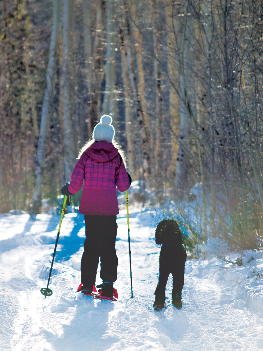
Beloved by locals as one of the quickest routes to getting in a skinny ski fix, Fooses Creek Trail affords not only quick access from Salida (about a 15-minute drive by car or hitch by thumb) but also varied terrain and numerous route options, making it a trail with something for everyone in all seasons.
The trailhead approach begins about 9.5 miles west of the intersection of U.S. Hwys. 50 and 285 in Poncha Springs. Traveling west on 50, take a left turn onto C.R. 225 and drive a snowy, usually plowed road about .7 miles to the parking for Fooses.
Youngsters along for the adventure will appreciate seeing Fooses Lake at the start of the trail (elevation 8,920 feet) and likely will be curious as to whether it’s frozen enough to skate on during the colder months. It’s actually a small reservoir and the water flowing out of it to the east to a hydroelectric plant at lower elevations tends to keep the lake soft just beneath the surface all winter.
Passing the lake, the gentle terrain of the double track in the first two miles of the trail make the route fantastic for side by side snowshoeing or Nordic skiing. To the south of the trail, babbling Fooses Creek makes an appearance now and then, providing fresh water for dipping to fill canteens and a delightful opportunity for winter photographers.
At about 2.1 miles from the lake (be sure you stay on F.S.R. 225 and don’t take the turn for 225A at the one-mile mark), the trail forms a crossroads at the confluence of North and South Fooses Creeks. The fork to the right, or north, gets steep rapidly and in winter enters avalanche terrain, best explored only by folks equipped with beacons. North Fooses Creek Road eventually meets up with a steep slope under powerlines.
The southern route requires some route finding, is also steep and leads up to the Continental Divide, joining up with the Monarch Crest Trail at about 12,000 feet in elevation. This remote, low-use wilderness ingress is what makes Fooses truly extraordinary. Along this stretch, the South Fooses Creek Trail overlaps the Colorado Trail System for about 5.1 miles, giving visitors a taste of the beauty that awaits those who traverse the nearly 500-mile passage from Denver to Durango.
For winter enthusiasts, Fooses’ mostly shady locale is ideal since snow blankets the trail nearly all winter, but all seasons on the trail provide ample moments for backcountry experiences. To view the trail in topographic detail, pick up a copy of the Latitude 40 Salida Buena Vista Colorado Trails Map.
Ericka steps into a pair of skinny skis every chance she gets and affectionately remembers her Minnesota childhood, when the snow piled as high as the house. View her work at erickakastner.com.