By John Mattingly
Note: The second part of the water series will be brief (requiring reader participation) and will be followed by a Rainbow Trail postscript.
Anyone who had the persistence to read my column last month to the end (I commend your patience) understands that, after discussing the particulars of a point of diversion, I made the argument that the stated points of diversion for all irrigation wells in the San Luis Valley should be underground.
By statutory definition, a point of diversion is that point where a water user “removes water from the water body.” For a well, that would be at the point of the pump bowls, not the surface of the ground. Yet, as I indicated last month, it may be that the water models currently being developed to determine injury relationships between ground water and surface water rights in the San Luis Valley assume the ground water is removed from the relevant water body at the surface of the ground. It simply is not.
Most wells in the Valley are at least a hundred feet deep, which doesn’t seem that much at first glance. In the case of a surface water point of diversion, a hundred feet one way or another from its actual diversion point might not be of much consequence because the one hundred feet in question is in an east-west, north-south plane.
However, the hundred feet we’re talking about with a well diversion is a hundred feet of elevation, which translates to a lot more than a hundred feet in the east-west, north-south plane. The Rio Grande, along with most streams on the floor of the San Luis Valley, run at about a one percent slope, or one foot of drop in a hundred feet. This means that a groundwater diversion from a one-hundred-foot well near a one percent sloping stream is nearly two miles downstream (100 x 100) from the wellhead.
Therefore, if a model was created to determine injury relationships between ground and surface water users, and that model assumed that all the wells in the subject area removed water from the water body at the well head, the error would be significant. The deeper the well, the greater the error.
To get a better sense of this argument, it’s time to get a blank piece of paper. Draw a squiggly line down the middle to represent a stream. Now, from top to bottom, along the squiggly line, place small squares labeled A, B, C, D, E, and F – each representing a point of diversion on the stream, with square A being priority number one, and square F being priority number five. Assume this is a stream with a one percent slope.
Now assume that Mr. F, the most downstream diverter on the stream in this example, and the appropriator with the most junior water right, has a pump at his point of diversion, F, and the decreed, historic use of his water right has been that his water is pumped in a pipeline two miles upstream to a field that is across from Ms. A’s field. Ms. A is the senior appropriator in this example, and thus senior to all others on the stream.
So, in this example, is there any conceivable fact pattern in which Ms. A can claim that Mr. F is injuring her water right? How about the holders of water rights at B, C, D, and E?
Well, in water wars, anything is possible.
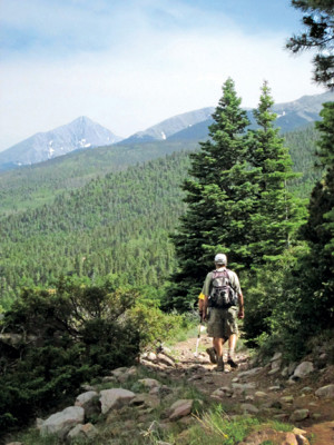
A friend of mine, call him E. Larry, came out from New York City to climb San Luis Peak. As a break-in hike, I decided to do Methodist Mountain on the Rainbow Trail. I’d been hearing the usual NYC Boasterisms from Larry since he’d arrived at the farm, and continuing even as we compared hiking gear. I’m pretty much a cheapskate when it comes to gear, except for hiking boots.
E. Larry is actually a great guy. We met back in the days when we sold EIO (Equity Investment Opportunities) to put investors together with distressed farmers during the agricultural real estate crunch of the mid-1980s. His only flaw is that he thinks NYC is the center of the universe. The New Yorker cartoon showing the Western U.S. as a brief, windblown bestiary between the Hudson River and San Francisco aptly summarized E. Larry’s opinion of the West. But, he’d heard about San Luis Peak, and was determined to summit. Before we did the main event, I wanted to see how he would do at a lower elevation under more moderate circumstances, thus, Methodist Mountain.
We registered at the highway box north of the Poncha summit and took off along the trail to the east, but we met no other hikers. It being a pleasant day in mid-July was not astounding, but it was a bit unusual. After passing under the power lines, looking down on a slight sliver of highway, we made the ascent to the ridge above, leaving most remnants of civilization behind.
There is a place on the upper ridge where the trail wends into a stand of young aspen. The first time I approached this section almost thirty years ago, I arrived in late afternoon. It struck me as alluring, even enchanting, the way the slanted light filtered through the aspen, the trail sticking out like the tail of a giant cat. Several times since I have hiked up there with a lunch and taken a nap in the shade before going on.
As E. Larry and I entered the dappled shade of the trees, our eyes were drawn to a clearing off to the southwest where a group of five women, in full regalia, were belly dancing to a boom box in the fretted afternoon light beneath the quaking aspen, bells and symbols clinking, slinking.
They did not speak and were not receptive to speech.
E. Larry stopped in his tracks. Picture it, a New York boaster, staring at five belly dancers performing in a clearing among pubescent aspen on the Rainbow Trail.
He said only: “A Turkish chimera.”
Ever since that day, my friend has stopped with the New York boosterisms. To me, at least.
John Mattingly cultivates prose, among other things, and was most recently seen near Creede.