he yearly monsoon has brought heavy rain and flash flooding to some, while completely skunking others just a few miles away, who received not even a drop of water. The sporadic nature of the storm systems reminds this author of the old rancher’s grumbled statement, “the only odd thing with weather is when it is normal.”
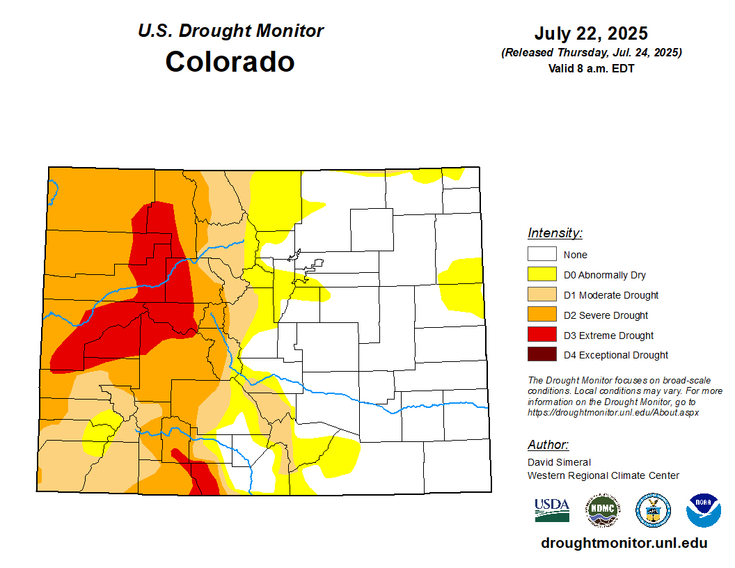
Due to the lack of winter snowpack and long periods of hot and dry conditions this summer, drought is once again creeping back into the region. According to the U.S. Drought Monitor, abnormally dry and moderate drought conditions have moved into the higher elevations of Upper Arkansas River Valley. Everything east of Cañon City has received normal rainfall, while to the west, the region is experiencing ever-worsening drought conditions the further one travels.
The land to the west of the Continental Divide in Colorado has been parched, with severe and extreme drought conditions along the Western Slope.
Yet, this week could bring some relief. Another monsoonal push of moisture will come from the south and mix with a cold front starting on Tuesday. Not only will it cool down most of Colorado, but it will also bring good chances of beneficial rain for a dry forest landscape.
Brian Bledsoe, the meteorologist host of the “Desert Farmer Podcast,” explained that this wet push comes before what he expects to be a dry August for much of the Southwest United States. In addition, Bledsoe has a particular speciality in watching the all-important El Niño-Southern Oscillation (ENSO) cycle in the Pacific Ocean. As strange as it may seem, the surface temperature of the Pacific Ocean at the equator has an enormous impact on snow and rain in the Southwest. Unfortunately, the La Niña cooler temperatures in the Pacific waters appear to be dominant, which suggests a dry fall and possibly less snow during the early winter.

The National Forest Service is not currently under any fire bans, but it does indicate that most of the forests are in a high fire danger status.
Jordan Hedberg