
By Vince Matthews
Not only can we have earthquakes here, but the 20th century witnessed two felt earthquakes in the Arkansas River Valley. And the scientific data shows us that we will have large earthquakes in the San Luis and Arkansas River Valleys in the future. What we don’t know is exactly where, or when.
Past earthquakes
At the turn of the last century, the following newspaper account on Nov. 15, 1901 described an earthquake felt in Buena Vista.
“At 3 o’clock this morning this city experienced an earthquake shock that lasted for about 6 seconds. Many people rushed from their residences in night attire, fearing their homes would be demolished. The large plate glass in one of the saloons collapsed and was crushed. The windows and the brick buildings were badly shaken. It is reported here that the waters of Cottonwood Lake rose considerably. Many large boulders on Mount Princeton and Mount Harvard rolled down the side of the mountain. The trembling seemed to travel from the southwest to the northeast. This is the first earthquake felt in Buena Vista and this morning is the general topic of conversation.”
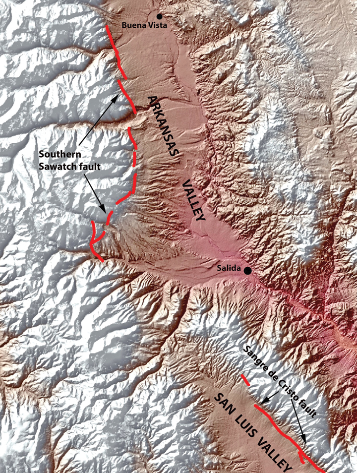
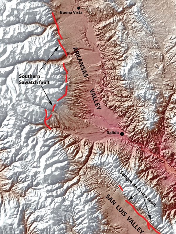
Decades later, an earthquake on Nov. 27, 1961 was felt with intensity IV in Leadville, Buena Vista, Fairplay and Jefferson. Both earthquakes were probably generated by the Southern Sawatch fault.
What causes earthquakes?
An earthquake is the vibration caused by movement of Earth’s crust on either side of a fault. The strong vibrations move out from the fault, through the crust, and cause shaking of objects at the surface. Bigger earthquakes send out stronger waves and they last longer.
What faults might generate earthquakes that would affect the Arkansas Valley?
[InContentAdTwo]There are hundreds of faults in the environs of the Arkansas Valley. Geologists know very little about the earthquake history and/or potential on most of these faults. However, two faults, the Southern Sawatch and the Sangre de Cristo, are well enough studied to be included in the USGS National Earthquake Hazard Map. Both of these faults have undergone thousands of feet of displacement as they uplifted the Sawatch and Sangre de Cristo Ranges in the past 20 million years. Each individual movement on the faults was less than 20 feet. These faults are listed as being capable of generating earthquakes of magnitude 7.25 and 7.5 respectively.
What losses might occur from an earthquake on one of the major faults?
The Federal Emergency Management Agency (FEMA) has a sophisticated computer model that can estimate losses from earthquakes. This model has been proven to be quite good at estimating losses for actual earthquakes that have occurred. The model estimates that a magnitude 7.25 earthquake on the Southern Sawatch fault could cause economic losses of $665.16 million in Chaffee County. The estimate for a 7.5 magnitude earthquake on the Sangre de Cristo fault is $425.76 million in Chaffee County.
What can I do to protect my home and loved ones?
Statistically, you are likely to be in bed when an earthquake occurs because one-third of your day is spent there. Therefore, a preventive move is to be sure no large objects that could be shaken loose are on the wall or shelf over the head of your bed. Another protective measure is to strap your natural gas, hot water heater to a wall so that it doesn’t get shaken over, break the connection, and start a fire. ?
For a nine-minute video on Colorado Earthquakes, visit:
www.youtube.com/watch?v=OE_NJEeQaB0&feature=youtu.be.
For the most comprehensive information on Colorado earthquakes, visit the Colorado Geological Survey’s website: www.coloradogeologicalsurvey.org/geologic-hazards/earthquakes-2/.
Vince Matthews lives in Leadville and retired as Director of the Colorado Geological Survey at the end of 2012. He is the editor and senior author of the multiple-award-winning book, Messages in Stone – Colorado’s Colorful Geology. Each morning he posts a photo and a note about the geology of the Arkansas Valley on Facebook/LeadvilleGeology.


Love to hear your questions.