by John Mattingly
To paraphrase Yogi Berra, “Forty percent is only thirty percent of the story.”
Colorado is listed at 66,387,700 acres, but in this column it will be revealed that Colorado is at least 80 million acres (perhaps as much as 100 million acres), and the actual percentage of those acres that are publicly owned is closer to 60 percent than 40. Meaning: Colorado is a lot bigger than the statistics represent, and the public piece of that perceived enlargement is much bigger than the stats state.
First, a little backstory related to this revelation.
In 1968 (while, quite possibly, under the influence of a psychotropic substance) I had a long discussion with a diminutive but pesky mathematician with a pocket protector, small fingers, and a special interest in oddities, who told me that New York City was actually bigger than Kansas. Topologically, that is. This remarkable mathematician had tallied up all the areas occupied by all the floors and stairwells of all the buildings in Manhattan, together with the areas of all the underground parking garages and all the subway passages, yielding a surface area for New York City that was close to that of Kansas. My response at the time was, “No wonder it takes so long to get anywhere in Manhattan.”
But the “topological point of view,” if you will, remained in my brain, merging with the 1975 question asked by Benoit Mandelbrot: How long is the coastline of Britain? The smaller the unit of measure and the greater the attention to every topological variation, the greater the answer. In one iteration, employing fractal mathematics down to the level of rocks, the length of Britain’s coastline proved longer than the circumference of the Earth.
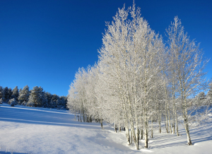
With topology and fractal math in mind, we now look at the state of Colorado with very different eyes. At first glance, we note that roughly the eastern one-third of Colorado is part of the Great Plains, but is, as my neighbor says, “flatter than piss on a plate.” His choice of simile might be influenced by an opinion of the Front Range shared by a few of the cranky ranchers who occupy the western two-thirds of the state, but that aside, when the western two-thirds of Colorado is presented topologically, it has remarkable and extensive variation. It is, in fact, a craggy, infinitely rugged surface that if measured on a fractal basis would yield at least 30 percent more area than is determined by survey maps (surveys assume the surface of the earth to be flat). And, interestingly, it is in the western two-thirds of Colorado that the great majority of the State’s public lands reside.
Before going into the influence of topology and fractal detail on the actual land area of the western two-thirds of Colorado, we should first identify the various components of the public lands. Official records state that of Colorado’s 66,387,700 acres, 26,458,890 (40 percent) are federal and state lands. Part of this is due to the fact that the rugged nature of Colorado’s western terrain made it unattractive for homesteading, so by the turn of the century about half of Colorado was either in limbo or under lingering, and largely unorganized, federal and state control. Starting with Teddy Roosevelt’s last minute declaration of national forests in the early 1900s, followed by BLM and Forest Service and state agency actions, the lands of Colorado less suitable for homesteading gradually became national treasures. In Colorado the official 26,458,890 acres of federal and state lands are largely within:
4 National Parks
7 National Monuments
11 National Forests
2 National Grasslands
41 Wilderness Areas
2 Conservation Areas
44 State Parks
307 State Wildlife Areas
8 Wildlife Refuges
3 Historic Trail
2 Historic Sites
In addition, there are 20 river headwaters in Colorado (seven interstate river headwaters), comprising 317,440 acres of water bodies (all water in Colorado is owned by the state). If consideration is given to incorporated municipal areas, military bases and facilities, state and federal highways and bridges, and Indian reservations, the total official land area of Colorado that is in public ownership is close to 50 percent. This estimate gets some support from the agricultural acreage of Colorado being about 31 million acres, or 46 percent of the official area of the state, the majority of this land being in the eastern one-third. And Colorado’s mean elevation is 6,800 feet, meaning there are a lot of vertical surfaces between the lowlands of the Arkansas River at the Kansas line (3,350 feet) and the summit of Mount Elbert (14,433 feet)
The western two-thirds of Colorado and its public lands, when viewed topologically, are much greater than the official 26 million acres. How much greater is really a matter of how much granular detail is applied in measurement.
For example, there are numerous examples of certain steep-faced mountain properties that initially survey as 80 acres, but can be subsequently surveyed and divided into two “40-acre tracts,” each of which actually contain 50, or as much as 60, acres of area.
Anyone who has bushwacked in Colorado’s high country knows that you need to make directional decisions based on a topological map. If you don’t, you can end up hiking two miles up and down a ravine to cover one mile of distance on a flat map.
We are fortunate to live in a state rich in natural resources, protected national lands and a lot more territory to appreciate than will ever show up on a map or in an official statistical record.
John Mattingly cultivates prose, among other things, and was most recently seen near Poncha Springs.